 Last weekend we decided to go to see Coronado State Monument which is just to the north of where we live near Rio Rancho, NM. in the town of Bernalillo, NM. First there was a sign telling us that these were the ancient ruins of Kuaua Pueblo. Kuaua is an old Pueblo word meaning 'evergreen'. Kuaua Pueblo (pueblo means 'town') was started in the 1300's and was made out of adobe which is a mixture of mud and straw that makes a good brick. By the 1500's it is thought that the town may have had as many 1200 rooms. This town is within sight of the Rio Grande River (this day we couldn't see the river as there were too many trees). These native Americans survived by hunting, fishing, and farming. They grew many of the same things that I now grow in my garden - squash, watermelons, corn, and beans. Corn was their staple food and was ground into a meal on special flat rocks using round rocks to make a meal which they used for a flat bread. This pueblo may have been a center for much trading among other tribes. The Spanish explorer Francisco Vasquez de Coronado
 found the village in 1540 while looking for the Seven Cities of Gold, which he never found because they didn't exist. Coronado had about 300 soldiers and 800 other Indians with him as well as about 1000 horses and other livestock. They spent the winter at Kuaua. This is where the monument got it's name of Coronado. It was excavated in about 1930 but many of the ruins that were above ground have disappeared with time and now most of the walls that you can see have been rebuilt to look like what was found. There was a square kiva or ceremonial chamber found underground that had many colorful murals in it. These murals can be seen in one special room at the visitors center but photos are not allowed so that more damage won't be done to them. I did find photos of them on a website and lots of information on them as well as the pueblo at these websites. The kiva can be entered and seen at some times but not on the day we were there. I did get to go into it when I was about 17 in about 1968. http://http://www.100megspopup.com/photo4phood/swarch/coronadohistory.html
http://http://www.nmmonuments.org/coronado-state-monument

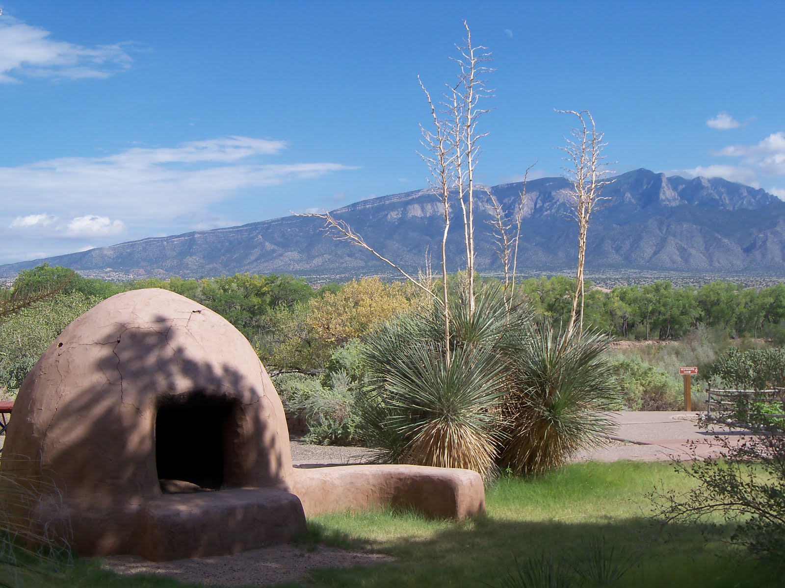
My 2nd photo shows one of the signs that you can find on a short walking tour of the ruins with information on the ruins. But the most important sign to see and remember while visiting here is the one telling you to give right of way to all Rattlesnakes. Rattlesnakes are found frequently on the cement and dirt trails where they like to sun themselves, but on this day we didn't see any. There are benches made out of logs for those that need to sit and rest and picnic tables with brush shades for resting and picnics. At the Visitors center was a modern-made wood cart like the Spanish would have used when they made the adventure to find the Seven Cities of Gold. The Visitors Center has a wonderfull, cool intrance way with huge yuccas in front of it. There are signs telling what a lot of the native plants are including the barrel cactus in the last photo. The cactus had buds on it but none were open. There was a Pueblo style oven in front of the Center. These ovens are still used to bake bread in at the pueblos.


 had about 300 soldiers and 800 other Indians with him as well as about 1000 horses and other livestock. They spent the winter at Kuaua. This is where the monument got it's name of Coronado. It was excavated in about 1930 but many of the ruins that were above ground have disappeared with time and now most of the walls that you can see have been rebuilt to look like what was found. There was a square kiva or ceremonial chamber found underground that had many colorful murals in it. These murals can be seen in one special room at the visitors center but photos are not allowed so that more damage won't be done to them. I did find photos of them on a website and lots of information on them as well as the pueblo at these websites. The kiva can be entered and seen at some times but not on the day we were there. I did get to go into it when I was about 17 in about 1968. http://http://www.100megspopup.com/photo4phood/swarch/coronadohistory.html
http://http://www.nmmonuments.org/coronado-state-monument

My 2nd photo shows one of the signs that you can find on a short walking tour of the ruins with information on the ruins. But the most important sign to see and remember while visiting here is the one telling you to give right of way to all Rattlesnakes. Rattlesnakes are found frequently on the cement and dirt trails where they like to sun themselves, but on this day we didn't see any. There are benches made out of logs for those that need to sit and rest and picnic tables with brush shades for resting and picnics. At the Visitors center was a modern-made wood cart like the Spanish would have used when they made the adventure to find the Seven Cities of Gold. The Visitors Center has a wonderfull, cool intrance way with huge yuccas in front of it. There are signs telling what a lot of the native plants are including the barrel cactus in the last photo. The cactus had buds on it but none were open. There was a Pueblo style oven in front of the Center. These ovens are still used to bake bread in at the pueblos.




 Posts
Posts


